
How Professional Surveyors Reestablish Missing Property Corners
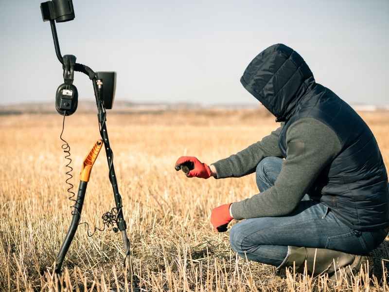
A missing property corner can stop a project cold. Maybe the old iron pin got paved over. Maybe it rusted away decades ago. Or a fence line shifted and nobody noticed. Either way, if you can’t find the marker, you can’t confirm where your land ends and your neighbor’s begins.
This comes up often and across. It happens most on older properties, where boundary markers were set generations ago. The good news is a missing corner is not the same as a lost boundary. A licensed surveyor has a clear process for reestablishing it. This uses evidence, math, and professional judgment, not guesswork.
Reviewing Deeds, Plats, and Prior Survey Records
Before a surveyor sets foot on the property, the work starts in the records. Deeds, recorded plats, and any past survey plans give the surveyor a starting point for where the corner should be.
This research usually includes:
- The current deed and its legal description
- Recorded plats showing the subdivision or original tract
- Any earlier surveys of the property or nearby parcels
- County tax maps and GIS records, used only as a general reference
Many older neighborhoods and rural parcels were platted decades ago. The paper trail isn’t always clean. Deeds sometimes point to monuments that no longer exist. They may also list measurements that don’t match modern equipment exactly. A surveyor has to account for this before ever picking up a shovel.
This also flags problems early. If a neighboring deed describes the same boundary line differently, the surveyor needs to know that before fieldwork starts.
Why Old Records Aren’t Always Enough
Old deeds and plats give direction, not certainty. Distances recorded decades ago were measured with different tools and methods. So the paper record is a guide, not the final word.
Searching for Surviving Boundary Evidence in the Field
Once the research is done, the surveyor heads to the property to search for physical evidence. This is where the real detective work happens.
A surveyor looks for:
- Original iron pins, pipes, or concrete monuments
- Old fence lines, hedgerows, or tree lines that may follow old boundaries
- Nearby property corners that help confirm a pattern
- Natural monuments named in old deeds, like streams or large trees
In parts of Columbus with thick tree cover or older homes, physical evidence can be buried under leaves, grown into trees, or covered by decades of yard work. A metal detector and a careful eye often find markers that look completely gone from the surface.
Not every corner has evidence left. Sometimes a pin was pulled during construction, or a monument was destroyed by grading. When that happens, the surveyor has to lean more on math and pattern evidence from the corners around it.
Comparing Record Measurements With Existing Survey Evidence
Once field evidence is collected, it gets compared against the measurements in the deed and plat. This shows how closely the physical evidence lines up with what the paper record says.
A surveyor checks:
- Distances and angles between found monuments
- Whether found evidence matches the recorded plat
- Patterns among multiple corners on the same property or block
- Differences that suggest a monument shifted or was replaced wrong
Small differences are common and often expected, since measurement tools and methods have changed over the decades. Bigger differences raise questions that need answers before the surveyor can reestablish the corner with confidence.
This step is where math and fieldwork come together. The surveyor is basically checking if the story told by the records matches the story told by the ground.
Applying Professional Judgment to Reestablish the Corner
This is what sets surveying apart from simple measuring. When evidence is missing, mixed, or partly destroyed, the surveyor has to use professional judgment to figure out the most likely original spot of the corner.
Georgia law and long-standing surveying rules give more weight to some types of evidence than others. Generally, original monuments carry more weight than measurements. Long-standing lines like fences can carry weight too, depending on the case. How these factors get weighed can change from case to case, so this isn’t something a property owner should try to figure out alone.
Judgment calls might involve:
- Weighing physical evidence against recorded measurements
- Considering long-standing fence lines or land use as supporting evidence
- Looking at how nearby surveys and corners fit together as a whole
- Deciding whether a corner was ever set correctly in the first place
This is a professional decision that takes training and experience. It’s not a simple measuring task. It’s also why two different surveyors might reasonably land on slightly different answers for a tricky corner. That’s why hiring a licensed, experienced surveyor matters.
When Boundary Disputes Come Up
If reestablishing a corner creates a conflict with a neighboring property, this may need to get worked out through talks, a boundary line agreement, or in some cases, legal action. A surveyor can point out the issue, but solving a dispute may need a lawyer.
Documenting the Reestablished Property Corner
Once the corner is reestablished, the surveyor sets a new monument and writes it all down. This creates a clear record for anyone who needs to check the boundary in the future.
Documentation usually includes:
- A new survey plat showing the reestablished corner and boundary lines
- A written report explaining the evidence used and the reasoning behind it
- Recording the survey with the county, when required
- Coordinates and monument descriptions for future reference
This record matters for property owners, title companies, lenders, and buyers. If a boundary question comes up again later, whether for a sale, a fence project, or new construction, this documentation gives everyone a solid reference point instead of starting over.
If your property has a closing date, a financing deadline, or planned construction near a boundary line, confirm early whether a corner needs to be reestablished. This process takes time, and starting early avoids delays later.