↓
 

Columbus Land Surveyors

Local Land Surveyors in Columbus, GA

Columbus Land Surveyors
  • Home
  • ALTA Survey
  • Boundary Surveying
  • Construction Survey
  • Drone LiDAR Mapping
  • Elevation Certificate
  • Land Surveying
  • Topographic Survey
  • Blog
  • Contact Us
Home - Page 2 << 1 2 3 4 … 11 12 >>

Post navigation

← Older posts
Newer posts →

Why Missing Property Line Markers Create Problems

Columbus Land Surveyors Posted on August 28, 2026 by ColumbusSurveyorAugust 27, 2026
Land surveyor using surveying equipment to locate property lines on a residential property in Columbus, GA.

You walk a lot and look for the corner pins. They’re not there. That happens more than you’d think. Property line markers get buried, paved over, or knocked out over the years. When they go missing, the exact edge of the land gets fuzzy. For a developer, that fuzzy edge can turn into a real problem. A fence, a wall, or a whole building can end up in the wrong spot. This piece walks through why missing markers cause trouble, and how the boundary gets sorted out.

A Missing Marker Does Not Mean a Missing Boundary

A marker and a boundary are two different things. The boundary is the legal edge of the land. It lives in the deed and on recorded maps. The marker is just a physical point that shows where that edge sits.

So a missing pin does not erase the line. The line still exists on paper. The corner still has a fixed spot on the earth. You just can’t see it marked at the moment.

Markers vanish for plain reasons. A pin can sink under years of dirt and grass. Grading, paving, or new construction can rip one out. Snow plows, mowers, and utility digs knock them loose too. A corner that was clear twenty years ago can be gone today.

Think of the marker as a signpost, not the road itself. If the signpost falls down, the road is still there. A surveyor can find where the corner belongs using records and math. The metal pin is helpful, but it is not the boundary.

This shapes how you should react. Don’t panic when a pin is gone. The land didn’t shrink or shift. The job is to prove where the line runs, not to invent a new one.

Old Records Often Hold Clues to the Original Corner

When markers vanish, the paper trail takes over. A surveyor starts with the deed. The deed describes the property in words and measurements. Those words point back to the original corners.

Plats add even more. A plat is a recorded map of the lot or the subdivision. It shows distances, angles, and how the parcel fits with its neighbors. Older plats can list the exact monuments once set at each corner.

Past surveys help too. A prior surveyor may have recorded what they found and set. Their notes can name a pipe, a rebar, or a stone at a corner. That gives a strong clue about where to look.

Neighboring records fill the gaps. The lots next door share lines with yours. Their deeds and surveys often describe the same corners from the other side. Put all these records together, and a clear picture of the original boundary starts to form.

Fences and Landscaping Can Give the Wrong Impression

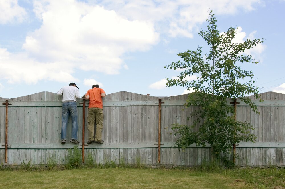
People assume the fence marks the line. Often it does not. A fence gets built where it’s easy, not where a survey says. Over the years, nobody checks if it’s right.

Hedges, walls, and driveways cause the same trouble. They look like clean edges of a property. But they were placed for looks or for use, not for legal accuracy. A driveway can sit a few feet inside or outside the true line.

Trusting these features is a common and costly mistake. A developer who builds an old fence may build in the wrong place. The new work could cross onto a neighbor’s land. It could also give away land that was yours to use.

Picture a lot with an old chain-link fence. A developer measures from the fence and plans the new build. Later a survey shows the fence sits four feet inside the real line. That’s four feet of usable land left on the table down the whole side. On a tight lot, that lost width can change what fits.

None of these features prove ownership. They show how the land has been used, not who owns what. A fence line and the legal line can be feet apart. Treating one as the other is how disputes get started.

A Property Line Survey Can Resolve Uncertain Locations

A property line survey settles the question with evidence. The surveyor gathers the records first. Then they head to the field to look for physical proof. The two sides get checked against each other.

In the field, they hunt for old evidence. A buried pin might still sit below the surface. An old fence post, a drill hole in concrete, or a marked tree can count as evidence too. A metal detector often helps find iron pins hidden under grass or soil.

Then comes the analysis. The surveyor compares what the records say to what the ground shows. Measurements from known points help place the missing corner. Where the evidence agrees, the corner gets set with confidence.

This is a real investigation, not a quick pin hunt. The surveyor weighs the deed, the plats, the neighbor lines, and the field marks together. That’s how a solid boundary opinion gets formed. When the work is done, the corners can be marked again for everyone to see.

You also get a record you can act on. The surveyor can set fresh pins at each corner. They can hand you a drawing that shows the lines and the evidence found. That paperwork holds weight with lenders, builders, and neighbors alike.

Small Boundary Questions Can Become Expensive Problems

A small guess about the line can cost a lot later. Say a developer builds a fence three feet off. The neighbor gets a survey and finds the error. Now the fence has to move, and that’s money gone.

The same risk hits bigger work. An addition, a driveway, or a retaining wall built over the line is worse. Moving a structure costs far more than moving a fence. Some cases even end up in court, which drains time and cash.

A purchase carries risk too. Buy a lot based on a wrong line, and you may pay for land you don’t get. You might also inherit an encroachment from a past owner. That problem becomes yours the day you close.

Solving the question early is cheap by comparison. A survey before you build, buy, or fight is money well spent. It turns a guess into a known fact. That one step can save a project from a slow, costly mess.

Missing property line markers are a nuisance, not a dead end. The boundary is still there, written in the records and fixed on the ground. A good surveyor can find it again with proof, not guesswork. Before you spend on fences, foundations, or a land deal, get the line confirmed. It’s a small cost that keeps a small question from growing into a big one.

Posted in boundary surveying | Tagged boundary survey

When a Plat of Survey Is Required

Columbus Land Surveyors Posted on August 27, 2026 by ColumbusSurveyorAugust 26, 2026
Land surveyor documenting property boundaries and site features for a plat of survey in Columbus, GA.

A plat of survey is one of those documents people order without knowing why they need it. Then a lender asks for it, or a permit stalls, and suddenly it matters. A plat of survey is a drawing that shows your property’s boundaries and the features on it. Knowing when you actually need one saves you from scrambling later. For a developer, ordering the right survey at the right time keeps a project moving instead of stuck at a desk waiting on paper.

A Plat of Survey Becomes Important When Property Decisions Depend on Exact Site Information

Land surveyor documenting property boundaries and site features for a plat of survey in Columbus, GA.

A plat matters most when a decision depends on knowing exactly where things sit. Not a rough idea. Exact lines and exact features, drawn and measured.

Plenty of situations can trigger that need. Buying or selling a property, building something new, getting a loan, splitting a parcel, or starting a development project may all require clear information about the boundaries and existing features.

The common thread is risk. When money or permits hinge on the property’s real shape, a guess won’t do. A plat gives everyone the same accurate picture to work from. Skip it, and you’re making major decisions based on an uncertain view of the land. A documented survey turns that uncertainty into information you can plan around.

Property Boundaries Often Need to Be Shown Before Improvements Are Planned

Before you build anything, you need to know where you can build. That starts with documented boundaries. A plat shows them clearly, so your plans stay within the property you own.

This comes up more than people expect. A homeowner may want to put up a fence and needs to know the actual line. A developer may plan an addition and need to meet required setbacks. Someone may also need accurate boundaries before adding a driveway, garage, or other structure near a property edge.

The reason is simple. Build in the wrong spot and you could cross a property line or violate a setback. Fixing that after construction can be painful and costly. A plat gives your designer and builder a firm reference to work from. They can place improvements with confidence instead of relying on an old fence or other feature that may not mark the legal boundary.

Recorded Easements Can Matter as Much as the Property Lines

Boundaries get most of the attention, but easements can matter just as much. An easement gives another party certain rights to use part of your property. That area may overlap the exact location where you hoped to build.

A plat can show or reference these interests so they don’t catch you by surprise. Common examples include:

  • Utility easements for power, water, or sewer lines
  • Access easements or shared driveways
  • Rights-of-way along roads or corridors
  • Drainage easements that carry water across the parcel

Each one can affect how you use the land. A utility easement may restrict construction, while an access easement may control how people reach the property. Knowing about these restrictions before design begins gives you time to adjust the plan. The goal is to find those limits while you still have options.

Lenders, Buyers, and Local Agencies May Need Different Survey Information

Not every survey serves the same purpose, and different parties may ask for different information. The reason behind the request usually determines which type of survey is appropriate.

A simple property purchase may call for a boundary survey showing the property lines. A lender involved in a commercial transaction may require an ALTA survey with additional title and improvement information. A local agency reviewing a permit may have its own documentation requirements. A subdivision project requires information that supports the creation and recording of new parcels.

Ordering the wrong type can waste both time and money. If you order a basic survey when a lender requires an ALTA survey, you may have to pay for additional work later. Before placing an order, ask the lender, title company, attorney, or local agency exactly what they need. Matching the survey to the purpose gives you a better chance of getting the right information the first time.

Knowing the Survey Requirement Early Can Prevent Delays Later

The best time to determine your survey needs is before the document becomes a deadline. Survey work can require record research, field measurements, drafting, and review. A last-minute request can delay a closing, permit, or construction schedule.

Confirming the requirement early helps avoid that problem. Your lender can explain what the loan requires. The title company can identify what may be needed for closing. Your attorney, designer, and local authority can also clarify requirements that apply to the project.

Get those answers before fieldwork begins, and the survey has a better chance of arriving when you need it. Wait too long, and a missing or incomplete survey can become the item holding up the entire project. Planning for it early gives you time to address issues without putting the rest of the schedule at risk.

Frequently Asked Questions

What is a plat of survey?

A plat of survey is a scaled drawing that presents information about a property, including its boundaries and certain features located during the survey. Depending on the survey and project, it may show structures, easements, rights-of-way, and other relevant details. Owners, lenders, designers, and local agencies can use it to understand the property. It provides a clear reference for decisions involving the land.

When do I need a plat of survey?

You may need one when buying, selling, building, financing, or dividing property. It can also be useful before adding fences, driveways, or structures close to a property boundary. Lenders and local agencies may have their own survey requirements. Confirming the need early with the appropriate party helps you order the right survey on time.

Is a plat of survey the same as a boundary survey?

They are related but are not always interchangeable terms. A boundary survey focuses on establishing or locating property lines, while a plat is the drawing used to present survey information. The final product depends on the purpose and the requirements of the project. Ask the surveyor, lender, or reviewing agency which survey and deliverable they require.

Does a plat of survey show easements?

It can show or reference easements that are recorded and relevant to the property. Utility, access, and drainage easements may affect where improvements can be placed. Reviewing them early helps you understand restrictions that could affect your plans. The exact information shown depends on the survey scope and available records.

How do I know which survey type to order?

Start with the reason you need the survey. A boundary survey may work for some property decisions, while a commercial lender may require an ALTA survey. Local agencies and subdivision projects can have additional requirements. Ask the lender, title company, attorney, or reviewing authority what they expect before ordering the survey.

Posted in land surveying | Tagged Land Surveying, land surveying columbus

What Surveyors Use Today to Measure Property Boundaries

Columbus Land Surveyors Posted on August 20, 2026 by ColumbusSurveyorAugust 18, 2026
Property surveyor in Columbus GA using modern GPS and total station equipment to measure property boundaries and locate corner monuments.

People think a property surveyor just walks the land with tape and marks the corners. The real work mixes precise field gear with old records and physical evidence. A modern survey pulls all three together to find where your lines actually run. Knowing the tools and the method helps you understand what you’re paying for and why the result holds up.

How Do Surveyors Measure Property Boundaries Today?

A property surveyor measures boundaries by collecting exact points in the field, then tying them to the record. The field crew locates corners, marks distances and shoots angles between points. Those measurements build a precise picture of the property on the ground.

The field work is only half the job. The surveyor combines the measurements with the property records and the physical evidence on site. A found iron pin, an old fence line or a corner monument all feed the answer. The measurements say where things are. The records and evidence say what those things mean.

That mix is what makes a survey reliable. A crew can measure a point to a fraction of an inch. The skill is deciding which points define the legal line. The surveyor weighs the field data against the record to reach that call.

The order of work matters too. A crew usually starts by setting reliable reference points across the property. From those, they measure out to the corners and features. Working from a solid base keeps every later measurement tied to the same framework, so the whole survey holds together.

What Tools Help Surveyors Locate Property Corners?

Surveyors use electronic instruments to measure points and distances with high accuracy. The workhorse is the total station. It sits over a known point and measures angles and distances to targets across the site. That gives the crew precise positions for corners and features.

The total station reads distance with a beam that bounces off a prism or a surface. It records the angle at the same time. Together those two readings fix a point in space. The crew moves the target around the property and builds a set of exact positions.

Data collectors round out the setup. The instrument feeds each measurement into a field computer, so the numbers get stored as the crew works. That cuts hand-writing errors and keeps the readings organized. The tools don’t replace the surveyor. They give the surveyor clean, precise data to work from.

Older tools still have a place. A steel tape or a hand level can check a short measurement or reach a spot the instrument can’t. The crew also carries gear to find buried markers, since a metal detector can turn up an iron pin hidden under years of soil and grass. The modern kit adds to the old basics rather than tossing them out.

How Does GPS Help Surveyors Measure Property Lines?

Satellite positioning helps a surveyor locate points in the field without line of sight between them. A GPS receiver reads signals from satellites to fix its position on the ground. On open sites, that lets the crew set control points and locate corners fast, even across long distances.

Survey-grade GPS is far more precise than the GPS in a phone. It uses correction methods to tighten the position down to survey tolerances. That accuracy is what makes it useful for boundary work instead of just rough navigation.

GPS rarely works alone. The crew often pairs it with the total station. GPS sets the control across the property, then the total station handles the tight measurements and the spots where trees or buildings block the sky. Using both lets the surveyor measure a boundary accurately across mixed conditions.

Site conditions decide how much GPS the crew leans on. A wide-open field is ideal, since the receiver has a clear view of the sky. A wooded lot or a spot between tall buildings blocks signals, so the crew shifts to the total station there. A good surveyor reads the site and picks the right tool for each part of it.

How Do Surveyors Check Measurements Against Property Records?

Field measurements only tell part of the story. Precise numbers show where a pin or a corner sits, but not whether it marks the legal line. The surveyor has to check the field data against the record to answer that.

Records fill the gap. The surveyor pulls the deed, the recorded plat and past surveys, then compares them to what the crew found. Existing monuments get weighed too, since a found corner can carry real legal weight. These sources help establish where the boundary actually belongs:

  • the deed and its written description
  • the recorded plat for the lot or subdivision
  • existing monuments like iron pins or concrete markers
  • prior surveys of the property or neighbors
  • physical evidence such as long-standing fences

The surveyor compares the field evidence with the recorded information and looks for agreement or conflict. When they line up, the line is clear. When they don’t, the surveyor weighs which evidence controls. That judgment is the core of the work.

Conflicts come up more than people expect. A deed might call for a distance that doesn’t match a found pin. An old fence might sit a few feet off the recorded line. The surveyor doesn’t just pick the easy answer. They follow accepted rules about which evidence carries the most weight, then document how they reached the result.

Why Does Modern Survey Equipment Matter for Property Boundary Work?

Current equipment helps a surveyor collect and record measurements with accuracy that older methods couldn’t reach. Precise instruments mean the positions are right, which matters when a few inches decide where a line falls. Good gear lowers the odds of a measurement error carrying into the result.

Modern tools also speed the field work. A crew covers a site faster with a total station and GPS than with a tape and transit. That efficiency keeps costs down and gets you the survey sooner, without giving up accuracy.

There’s a record benefit too. Digital data collectors store each measurement cleanly, so the survey rests on organized, traceable readings. That makes the final drawing easier to defend and easier to reuse later. Better data in means a stronger survey out.

The accuracy also protects you down the road. A precise, well-documented survey stands up if a boundary question ever comes up with a neighbor, a buyer or a permit office. Loose measurements invite disputes. Tight ones settle them. For a developer or owner, that reliability is worth as much as the speed.

Posted in boundary surveying | Tagged boundary survey

Post navigation

← Older posts
Newer posts →
Get Quote Button
© Boxer Survey USA
Columbus Land Surveyors

Columbus, Georgia
Phone: (706) 405-3842

Web Development and SEO by:
AuburnBusiness.com, LLC

Privacy Policy | Terms of Use

The owner of this website, Boxer Survey USA, provides coordination of professional land surveying and engineering services in all 50 states. The professional surveying and engineering services provided to you will be conducted by fully licensed professionals in your state.

Privacy Policy
↑