When you buy commercial property, title insurance is one of the most important protections you can have. It covers you if a problem with the property’s ownership or legal status shows up after closing. But title insurance only works well when the title company has accurate, complete information about the property before they agree to cover it. That is where an ALTA survey helps reduce risk for everyone involved in the deal.
What Title Insurance Actually Covers
Title insurance protects property owners and lenders against financial losses that come from problems with a property’s title. A title is the legal record of who owns a property and what rights come with that ownership.
Some examples of what title insurance can cover include:
- Ownership claims from a previous owner or heir
- Errors in past deeds or public records
- Unpaid liens that were not discovered during the title search
- Fraud or forgery in the chain of ownership
- Rights or claims that were not recorded properly
There are two types of title insurance policies. One protects the lender. The other protects the buyer. In most commercial transactions, both are required.
Why Title Companies Need More Than a Records Search
A title search reviews public records to trace the history of ownership and identify any recorded claims on a property. It is a necessary step, but it has limits.
Public records do not always show everything. A drainage easement may have been established informally and never filed with the county. A neighboring building may have been constructed years ago with one corner sitting just over the property line. An old access path may have been used by others long enough to create a legal right, even if nothing was ever written down.
These are the kinds of problems a records search simply cannot find. The title company has no way to see them unless someone physically goes out to the property, measures it, and documents what is actually there.
That is exactly what an ALTA survey does.
How an ALTA Survey Closes the Gap
An ALTA survey gives the title company a verified, on-the-ground picture of the property. When the title company receives the completed survey, they can compare what the public records say against what actually exists at the site.
This comparison often reveals things that were not visible in the records alone. The surveyor documents physical conditions, such as where structures sit, where access exists, and where easements cross the land. The title company then reviews those findings and decides how they affect the coverage they are willing to offer.
In Georgia, many title insurers will not issue a commercial title policy at all until a satisfactory survey has been completed and reviewed. The survey is not a formality. It is a core part of how they assess what they are agreeing to insure.
How It Leads to Stronger Coverage
When a title company has a complete ALTA survey to work with, they can offer broader protection. Without one, they often have to add exceptions to the policy. An exception is a specific issue or risk that the policy will not cover.
A common example is an exception for matters that a survey would show. This language means the title company is not responsible for any boundary problems, encroachments, or easement issues that an inspection of the property might have revealed. In other words, if no survey was done, the buyer may have a policy that excludes some of the most common and costly real estate problems.
When an ALTA survey is provided, the title company can review those specific issues directly. If the survey shows no problems, the exception can often be removed, which gives the buyer and lender a much stronger policy.
What the Survey Reveals That Changes Coverage
An ALTA survey can uncover issues that directly affect what the title company will and will not insure. Some of the most common findings that influence coverage include:
Encroachments. A structure from a neighboring property that crosses the boundary line. The title company needs to know this exists before agreeing to insure a clear title.
Unrecorded easements. A utility company or neighbor may have a right to use part of the property that was never filed in the public record. The survey can document this even when the records do not.
Access issues. If the property does not have legal access to a public road, that is a significant title risk. The survey confirms whether access exists and how it is established.
Overlap with adjacent parcels. Sometimes the legal description in a deed does not match what is on the ground. Two deeds may describe land that overlaps, which creates a ownership conflict the title company must address before issuing a policy.
A Clearer Picture Before Closing
Title insurance and an ALTA survey work together. The survey gives the title company the information they need to provide meaningful coverage. The title policy then protects the buyer and lender if a problem comes up after the deal is done.
For commercial property buyers, understanding this relationship helps explain why both are standard requirements in almost every transaction.
Frequently Asked Questions
Does an ALTA survey guarantee that title insurance will be issued?
No. The survey gives the title company the information they need to make a decision, but it does not guarantee coverage. If the survey reveals serious problems, the title company may require those issues to be resolved before they agree to issue a policy.
What happens if a problem is found during the survey?
The buyer and seller are notified. In many cases, the issue can be corrected before closing. This might involve adjusting the purchase price, requiring the seller to resolve an encroachment, or obtaining a legal release for an easement. Finding the problem before closing is far better than discovering it afterward.
Can a title policy be updated later if the survey missed something?
Title insurance protects against issues that existed before the policy was issued. If something was missed at the time of closing, the policy may or may not provide coverage depending on the circumstances. This is one reason having an accurate, thorough ALTA survey matters so much.
Does every commercial property need both an ALTA survey and title insurance?
Most lenders require both as a condition of approving a commercial loan. Title insurance without a current survey leaves gaps in coverage. A survey without title insurance leaves the buyer exposed to financial risk if a title problem surfaces later. Together, they provide the most complete protection available.
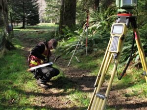 Land Surveyors are professionals who gake precise measurements to determine the size and boundaries of a piece of real estate. While this is a simplistic definition, boundary surveying is one of the most common types of surveying related to home and land owners. If you fall into the following categories, please click on the appropriate link for more information on that subject: