↓
 

Columbus Land Surveyors

Local Land Surveyors in Columbus, GA

Columbus Land Surveyors
  • Home
  • ALTA Survey
  • Boundary Surveying
  • Construction Survey
  • Drone LiDAR Mapping
  • Elevation Certificate
  • Land Surveying
  • Topographic Survey
  • Blog
  • Contact Us
Home - Page 3 << 1 2 3 4 5 … 11 12 >>

Post navigation

← Older posts
Newer posts →

How Land Surveying Supports Better Site Planning and Development

Columbus Land Surveyors Posted on August 18, 2026 by ColumbusSurveyorAugust 18, 2026
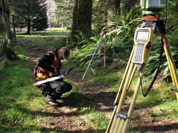
Land surveying team in Columbus GA reviewing site plans and drainage conditions during a development site evaluation.

A development plan is only as good as the ground truth behind it. Guess at the site, and the plan looks fine until the crew hits something the drawing missed. Land surveying gives developers hard facts about the property before the choices get locked. Those facts turn site planning from a hopeful sketch into a set of sound decisions. Better inputs make better plans.

How Does Land Surveying Help Developers Plan a Site

Land surveying gives the planning team an accurate read of the property. It measures the real land, then puts those numbers in front of the people making decisions. That early read shapes the plan while it’s still open to change.

Accurate measurements let a team understand the land before the plans are set. They see the true size, the real distances and what already sits on the site. A developer working from that has a clear picture, not a rough idea. The design starts from what the property actually is.

Better information leads to better choices. A developer deciding how to use a site leans on the facts in front of them. Solid measurements make those calls stronger. You pick a layout that fits the land, because you can see the land clearly from the start.

What Site Conditions Should Developers Review Before Planning

A developer should review the physical conditions that shape a layout. These are the things on the ground that decide what fits where. Miss them, and the plan drifts from reality.

Look at these before you plan:

  • existing buildings and structures
  • access areas and entrances
  • paved surfaces like drives and parking
  • ground changes such as slopes and low spots
  • other features tied to the planned work

Each condition steers the layout. A slope pushes the building to firmer ground. An existing structure claims part of the site. An access point decides where traffic enters. The plan has to bend around these, so a developer needs them mapped before the layout takes shape.

This isn’t about survey terms. It’s about the conditions that drive a plan. A tight site needs exact distances. A sloped site needs the grades. Match what you measure to what your project depends on, then plan against real conditions instead of assumptions.

How Can Survey Data Help Reduce Changes to Development Plans

Survey data helps designers catch conflicts early. They lay the proposed work over the real site and look for clashes. A building that lands on a slope shows up now, not during grading. Spotting the conflict on the drawing is cheap.

That early catch lets a developer fix problems before construction. You adjust the layout on paper while it costs almost nothing. You move the drive, shift the pad or rethink the grade before a crew mobilizes. The alternative is finding the clash in the field, where every fix runs up the bill.

Rework is what drags a project down. Delays stack up. Costs climb. A plan built on early survey data holds together, so the work runs with fewer surprises. Fewer changes late means a smoother path from plan to finished site.

How Does Land Surveying Help Teams Work From the Same Site Information

Land surveying gives every team one shared set of facts. The developer, the architect, the engineer and the builder all work from the same measurements. Nobody guesses, and nobody works off a different version of the site.

Shared data improves how the team talks. When a question comes up about where something goes, everyone checks the same drawing. The engineer sizes the grading to the same grades the architect designed to. The builder lays out the work from the same points the plan used. That common base cuts the mix-ups that slow a project.

Accurate measurements keep the plans lined up. When each professional builds on the same current information, their drawings agree. When they work from different or outdated data, the plans clash and someone pays to reconcile them. One reliable survey keeps the whole team pointed the same way.

Why Should Developers Include Land Surveying Early in Site Development

Survey work should happen early enough to shape the design. If the measurements arrive after the layout is set, they can only confirm what’s already drawn. Bring them in before the design locks, and they steer the plan toward what the site can hold.

Early data supports more than the layout. It helps a developer plan the budget with fewer unknowns, since you price the work against real conditions. It helps the schedule too, because you build the timeline around facts instead of hopes. A surprise found after the plan is set can wreck both the budget and the calendar.

Site layout gains the most from an early start. The building placement, the access and the use of the land all rest on the survey. Get those facts up front, and each decision sits on solid ground. Wait, and you risk designing something the property can’t support.

For a developer planning a project, early land surveying sets up everything that follows. You start with an accurate picture. You make each planning choice with real facts. You hand your team a plan that matches the property. That early investment is what keeps a development on track once the work begins.

Posted in land surveying | Tagged Land Surveying, land surveying columbus, land surveying importance

How an Elevation Survey Helps Evaluate Ground Conditions Before Site Improvements

Columbus Land Surveyors Posted on August 13, 2026 by ColumbusSurveyorAugust 10, 2026
Elevation survey in Columbus GA measuring ground levels, slopes, and drainage conditions before site improvements.

A lot can look flat and still fool you. Small dips and rises you can’t see with the eye change how water moves and where a building should sit. An elevation survey measures those height differences with real numbers. It tells you the vertical shape of the ground before you spend money on site work. For developers planning improvements on a Columbus GA property, that data replaces guesswork with facts. Skip it and you risk designing around a slope that isn’t really there. Here’s how an elevation survey helps you read the ground before the first load of dirt moves.

Why Ground Elevation Matters Before Site Work Begins

Ground height shapes almost every site decision. It controls how water drains, how much grading you need, how vehicles reach the site and where a building can sit. Get the height wrong and water runs the wrong way or a driveway climbs too steep. A property can look flat and still hide real elevation changes. A few inches across a parking area can decide whether it drains or ponds. The eye misses those small differences, and a tape measure won’t catch them either. An elevation survey solves that. A surveyor measures exact heights across the property and turns them into data. Owners, engineers and contractors then work from measured numbers instead of a guess about which way the land tilts.

What an Elevation Survey Measures Across a Property

An elevation survey records the vertical height of the ground at many points across a site. A surveyor takes readings at selected spots, each tied to a known height reference. The denser the points, the clearer the picture of the surface.

An elevation survey may capture features like these:

  • Existing ground levels
  • High and low points
  • Driveways
  • Building pads
  • Drainage paths
  • Curbs and pavement
  • Nearby structures or improvements

Put those points together and the flat-looking lot shows its true shape. You see where the ground rises, where it dips and how the surface moves between them. That vertical map is what a design team needs before it plans any change to the site.

How Elevation Data Helps Identify Areas That May Need Grading

Elevation data points straight to the spots that may need work. Low areas show where water can collect and sit after a storm. Steep sections show where a slope may be too sharp for a driveway, a pad or safe access. Those are the places a design team looks at first. With the numbers in hand, designers can test whether an area needs fill to raise it or excavation to cut it down. They can weigh how much grading a plan really takes. The survey does not design the fix. It supplies the measured heights, and the engineer decides how to grade the site to make the improvement work. Good numbers up front keep that grading plan grounded in the real surface.

Why Elevation Surveys Are Useful Before Driveways, Buildings, and Drainage Improvements

Elevation data pays off across several kinds of site work. For a new building, it helps set the right finished elevation so the structure sits above the water that runs toward it. For a driveway, it lets a designer plan a slope that a car can climb and that still drains. Drainage improvements lean on the same data, since you can’t route water without knowing the high and low points. The numbers also help you tie new work into what’s already there. A new drive has to meet the existing pavement at a matching grade, or you get a bump or a lip. The same goes for transitions to a neighbor’s ground, where a mismatch can send water across a property line. Measuring all of this early keeps a design assumption from turning into a field problem. A slope that looked fine on a rough sketch can fail once real heights come in, and catching that on paper costs far less than fixing it in the dirt.

How Elevation Survey Information Supports Better Site Planning

An elevation survey is only as useful as the people who put it to work. The surveyor hands the data to the whole team. Architects use it to place buildings that fit the ground. Engineers design grading and drainage from the same numbers. Contractors price and plan the dirt work with it. Permitting staff check the plan against local rules. When everyone starts from the same measured heights, the design comes together with fewer clashes. Reliable existing-condition data also cuts the surprises that blow up budgets. A team that knows the real ground does less redesign. It hits fewer sudden grading changes once work starts. And field crews make fewer scramble adjustments. Accurate elevation data up front is cheap insurance against expensive changes later.

Frequently Asked Questions

What is an elevation survey?

An elevation survey measures the vertical height of the ground at many points across a property. A surveyor ties each reading to a known height reference, which builds a clear picture of how the land rises and falls.

How is an elevation survey different from an elevation certificate?

They serve different jobs. An elevation survey maps the height of the ground to guide grading, drainage and site design. An elevation certificate is a specific document about a building’s elevation for flood insurance purposes.

Do I need an elevation survey if my lot looks flat?

Often yes. A flat-looking lot can still have height changes of a few inches that affect drainage and grading. Measured elevations catch differences the eye misses before they cause site problems.

Who uses the data from an elevation survey?

Architects, engineers, contractors and permitting staff all rely on it. The surveyor supplies the measured heights, and each team uses those numbers to design, price, build or review the site work.

Does an elevation survey include the grading design?

No. The surveyor measures and reports the existing heights. An engineer takes that data and designs the grading, deciding where to cut, fill or reshape the ground for the planned improvement.

Posted in elevation certificate | Tagged elevation certificate

How Construction Surveyors Help Contractors Maintain Accurate Project Layouts

Columbus Land Surveyors Posted on August 11, 2026 by ColumbusSurveyorAugust 10, 2026
Construction surveyors in Columbus GA using survey equipment and layout stakes to maintain accurate building placement on a jobsite.

A building starts as lines on a plan. Getting those lines into the ground in the right spot is where projects live or die. Construction surveyors handle that job for contractors. They turn the design into physical points a crew can build from, then check that the work stays true as it goes up. On a Columbus GA jobsite, one bad reference point can throw off a whole foundation. That mistake costs real money to fix, and it eats the schedule too. Here’s how construction surveyors keep your project layout accurate from the first stake to the final phase.

How Survey Control Creates a Reliable Reference for the Entire Project

Every accurate layout starts with survey control. Control points are fixed markers with known positions. The surveyor sets them before layout begins. Each one has an exact horizontal location and a set elevation. Think of them as the anchor points for the whole site. Every measurement on the job ties back to these same points.

That shared reference is what keeps a big site consistent. Without it, one crew might measure from a fence and another from a curb. Small differences pile up fast. A foundation set from the wrong start point can push everything out of line. Reliable control removes that risk. When the excavator, the concrete crew and the framer all work from the same control, their work lines up the way the plans intended. Good control also gives you a way to recover. If a stake gets knocked out or a corner gets buried, the surveyor can reset it from the control network instead of guessing. That saves a crew from rebuilding off a bad mark.

How Construction Surveyors Transfer Design Plans Into the Field

Construction surveyors turn the paper plan into marks you can build from. The design carries dimensions, coordinates, elevations and alignments. A surveyor reads those numbers and stakes the matching points on the actual site. Crews often call this work stakeout or layout.

Construction surveyors lay out points for items like these:

  • Building corners
  • Foundations
  • Columns
  • Curbs
  • Roads
  • Utilities
  • Drainage structures

Each stake tells the crew exactly where an element goes. The surveyor connects the designer’s intent with the real ground. Get that link right and the building sits exactly where the plan put it. Get it wrong and the crew builds an accurate version of the wrong location. Layout also carries the numbers a crew can’t eyeball, like a precise finished floor elevation or the slope on a drain line. A surveyor marks those grades so the work drains and fits the way the engineer designed it. Fresh marks matter here. Heavy equipment wipes out stakes fast, so surveyors often return to re-stake an area right before that trade starts.

Why Layout Checks Matter at Different Stages of Construction

Layout is not a one-time task at the start of the job. A good construction surveyor checks the work at several points as the project moves. Before excavation, they confirm the dig lines and depths. Before foundations pour, they verify the forms sit in the right place at the right elevation. They check again before structural work, utilities and paving. Each phase builds on the one before it.

This is where checks earn their cost. A small error in an early phase disappears under later work. Catch it at the foundation stage and you fix it cheap. Find it after the walls are up and the repair gets ugly. A footing poured a few inches off might force a redesign of everything above it. Verifying positions and elevations between phases keeps one hidden mistake from wrecking everything stacked on top of it. These checks also create a record. When the surveyor confirms each phase, the contractor has proof the work matched the plan, which helps with inspections and with any dispute later on.

How Construction Surveyors Help Coordinate Multiple Trades on One Site

A jobsite runs many trades at once, and they all lean on the same project geometry. Excavators, concrete crews, utility installers and pavers each need their piece to line up with the others. When one surveyor sets the layout from shared control, those pieces fit together. Building lines match the utility routes below them. Pavement meets the curbs at the right grade. Site features land where the plan shows them.

This coordination gets harder on tight sites. When a project has tight tolerances or little room to work, a few inches of error can stop a trade cold. A utility line staked a foot off might clash with a footing. A misplaced curb can leave a drive aisle too narrow for code. Accurate layout keeps every trade working from the same truth, so they don’t build conflicts into the site. It also cuts the finger-pointing. When each crew builds to the same surveyed marks, a clash is easier to trace and faster to sort out. That keeps trades from stacking up and waiting on each other.

What Happens When Field Conditions Differ From the Design Plans

Sometimes the real site does not match what the plan shows. An old foundation turns up where the plans showed nothing. A utility sits deeper than the drawings said. The existing grade comes in higher than expected. These conflicts are normal on real projects, especially on redevelopment sites with a long history.

When one shows up, a construction surveyor measures and records the actual condition in the field. They document exactly what is there and where it sits. Then the contractor and the design team review that data and decide how to handle it. A surveyor does not redraw the plans or guess at a fix on their own. That call belongs to the engineer or architect. The surveyor’s job is to hand everyone accurate field facts, so the people with authority can make a sound decision. Good field data turns a surprise into a manageable problem instead of a costly guess. Catching the conflict early also protects the budget, since a change worked out on paper almost always beats one discovered after the concrete truck shows up.

Posted in construction | Tagged construction survey

Post navigation

← Older posts
Newer posts →
Get Quote Button
© Boxer Survey USA
Columbus Land Surveyors

Columbus, Georgia
Phone: (706) 405-3842

Web Development and SEO by:
AuburnBusiness.com, LLC

Privacy Policy | Terms of Use

The owner of this website, Boxer Survey USA, provides coordination of professional land surveying and engineering services in all 50 states. The professional surveying and engineering services provided to you will be conducted by fully licensed professionals in your state.

Privacy Policy
↑